
UAV-Based Environmental Monitoring of Rip-Current Indicators Using Wavelet-Derived Texture Features
Source: arXiv:2608.02448 · Published 2026-08-03 · By Yonatan Ben Avraham, Baruch Binyaminov, Yehudit Aperstein
TL;DR
This study addresses the challenging problem of automated rip-current detection and localization from UAV-acquired standard RGB imagery, which is critical for beach safety yet difficult due to the subtle visual signatures of rip currents and environmental variability. The authors present a physically informed coastal hazard monitoring workflow that integrates wavelet-derived spatial-frequency texture features obtained via Discrete Wavelet Transform (DWT) with convolutional neural networks. They explore multiple strategies to fuse wavelet features into deep learning models, including a computationally efficient channel replacement approach that substitutes the red RGB channel with a wavelet energy map, and a more complex dual-stream CNN architecture fusing spatial and spectral streams with attention mechanisms. Evaluation on the publicly available Rip Current Monitoring dataset (2246 images) compares these architectures against RGB baselines for image-level classification and YOLOv8-based object detection. Results demonstrate that incorporating wavelet-derived texture features improves both classification and localization performance. The dual-stream model achieves over 95% accuracy with high recall for presence classification, while the channel replacement approach enhances YOLOv8 localization to 94% mAP@50. Explainable AI techniques confirm that model attention aligns with physically meaningful rip-current wave-gap regions, improving operational interpretability. These findings suggest that physically informed spectral-spatial fusion can enhance UAV-based rip current monitoring, potentially aiding lifeguards and coastal managers by providing more reliable, interpretable hazard detection tools.
Key findings
- Dual-stream CNN model integrating RGB and 4-channel wavelet sub-bands exceeds 95% classification accuracy and achieves high recall on the Rip Current Monitoring dataset (2246 images).
- Channel replacement strategy substituting the red channel with a wavelet energy map boosts YOLOv8 nano object detector performance to 94% mAP@50 for rip-current localization, outperforming RGB-only input.
- Pure wavelet-only input models perform worse than wavelet-RGB fused architectures, indicating complementary information in both spectral and spatial domains.
- Early fusion (concatenating wavelet energy as a 4th channel to RGB) improves accuracy over baseline RGB but underperforms compared to channel replacement and dual-stream fusion.
- XAI analyses (Grad-CAM++, EigenCAM) reveal that models attend to plausible rip current features such as wave gaps and foam texture discontinuities rather than background artifacts.
- Data leakage analysis via perceptual hashing confirmed no near-duplicate images across training and test sets, validating independent evaluation.
- Replacing the red channel is physically motivated since red wavelengths attenuate more in aquatic environments, and green-blue channels retain more underwater structure.
- Attention modules (CBAM) in the dual-stream architecture help emphasize relevant spectral channels and spatial regions corresponding to rip hazards.
Threat model
The adversary is not modeled as a malicious agent but rather the challenge is to detect subtle visual rip-current signatures from UAV imagery in the presence of natural environmental noise, varying illumination, sea states, and imaging artifacts. The system assumes no adversarial attack but must reliably discriminate rip hazards from complex surf-zone patterns.
Methodology — deep read
The threat model assumes a UAV-based coastal monitoring system attempting to detect naturally occurring rip currents as hazardous surface features. The adversary is not explicitly modelled since this is an environmental hazard detection task rather than a security defense scenario, but the method must handle environmental noise, variable illumination, and natural water surface complexity that can confound visual recognition.
Data provenance: The study uses the publicly available Rip Current Monitoring dataset v1 from Roboflow Universe, consisting of 2,246 RGB aerial coastal images with manually annotated rip current bounding boxes. The data reflects diverse nearshore conditions, water turbidity, and sea states. The official split of 1,566 training, 453 validation, and 227 test images is used without overlap. Images are resized to 320x320 for classification, with EXIF metadata stripped. For object detection with YOLOv8, images keep full resolution but are dynamically resized to 640x640.
Preprocessing includes bottom cropping 20% of images for classification to exclude shoreline land features and focus on surf zone hydrodynamics. For detection, cropping is disabled to preserve bounding box coordinates.
The main physical signal representation is derived via a single-level two-dimensional discrete wavelet transform (DWT) using Daubechies 4 wavelets on grayscale versions of the images. This produces four sub-bands: approximation (LL) and three detail sub-bands (LH-horizontal, HL-vertical, HH-diagonal). A wavelet energy map W is computed by summing the absolute values of the three detail bands and normalizing, capturing localized texture gradients from foam patterns and wave breaks.
Architecturally, the binary classification models include a dual-stream CNN with two parallel branches: a spatial stream processes RGB imagery, and a spectral stream processes the 4-channel wavelet sub-bands (LL, LH, HL, HH). Both branches share the same backbone structure (convolutions, batch norm, ReLU). Feature maps from both streams are concatenated, then passed through a convolutional block attention module (CBAM) that applies sequential channel and spatial attention to emphasize informative features. The fused features feed into fully connected classifier layers.
Four single-stream baseline classifiers are also evaluated: (1) RGB baseline; (2) pure wavelet input; (3) early fusion of RGB plus wavelet energy as a 4th channel; and (4) a channel replacement input where the red RGB channel is replaced with the wavelet energy map W, keeping G and B unchanged.
For object detection, the YOLOv8 nano architecture (PyTorch Ultralytics implementation) is used. The input layer is modified to accept the W-G-B channel replaced images, preserving the 3-channel input shape. YOLOv8's anchor-free, decoupled head architecture provides precise localization of irregularly shaped rip current regions in full-frame 640x640 images.
Training uses Adam optimization with 0.001 learning rate and binary cross-entropy loss for classification, with batch size 32 and early stopping after 15 epochs of stagnant validation loss, for up to 100 epochs. YOLOv8 training follows default hyperparameters with standard data augmentation.
Evaluation metrics for classification include accuracy, precision, recall, and F1-score, with a focus on recall due to the safety-critical need to minimize missed rip current detections. For localization, mean average precision at IoU threshold 0.5 (mAP@50) is reported. Ablation studies compare different spectral-spatial fusion schemes.
Explainable AI methods applied include Grad-CAM++ and EigenCAM to visualize model attention and verify alignment with physically plausible rip current wave-gap regions, validating interpretability.
To prevent data leakage inflating results, perceptual hashing (pHash) compared training and test images with Hamming distance threshold ≤5, finding no near duplicates.
In an end-to-end example, an input UAV image is preprocessed with bottom cropping, resized, and transformed by DWT to generate spectral maps. These feed into spatial and spectral CNN streams, features are fused via concatenation and attention, and a binary prediction of rip presence is generated. For detection, the W-G-B channel replaced image is input directly to YOLOv8 that outputs bounding box predictions localized to rip current regions.
Code or model weights are not explicitly stated as released, but dataset is public and public YOLOv8 API is used, supporting reproducibility.
Technical innovations
- Introduction of a channel replacement strategy that substitutes the red RGB channel with a physically meaningful wavelet energy map derived from DWT sub-bands for hydrodynamic texture embedding.
- Design of a dual-stream CNN architecture fusing spatial RGB features and spectral wavelet features in parallel, enhanced by a convolutional block attention module (CBAM) for improved rip-current presence classification.
- Application of explainable AI methods (Grad-CAM++, EigenCAM) to confirm model attention focuses on physically interpretable rip current indicators rather than noise or background artifacts.
- Comprehensive comparison of multiple spectral-spatial fusion methods (channel replacement, early fusion, hue-saturation-wavelet, wavelet composite) within a unified UAV-based rip current detection workflow.
Datasets
- Rip Current Monitoring v1 — 2,246 coastal UAV images — publicly available via Roboflow Universe
Baselines vs proposed
- RGB baseline classification: accuracy ~<95% vs dual-stream fusion: >95%
- Pure wavelet-only classification: lower than dual-stream and channel replacement (exact numbers not reported)
- Early fusion (RGB + wavelet energy 4-channel): improves over RGB alone but less than channel replacement or dual-stream
- YOLOv8 object detection with RGB input: mAP@50 <94% vs channel replacement W-G-B input: 94% mAP@50
Figures from the paper
Figures are reproduced from the source paper for academic discussion. Original copyright: the paper authors. See arXiv:2608.02448.
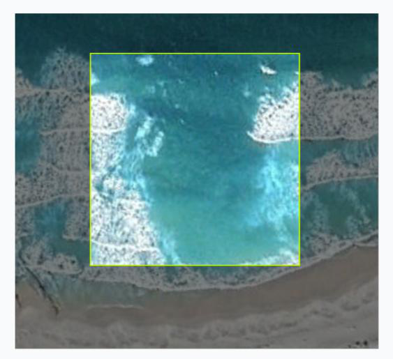
Fig 1: Representative dataset samples showing rip-current images (top row) and safe
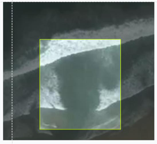
Fig 2: Channel Replacement workflow. A derived wavelet energy channel (W) replaces the
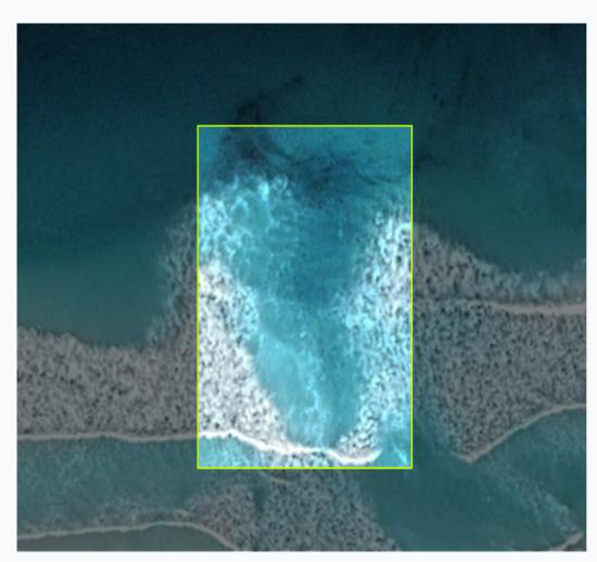
Fig 3 (page 7).
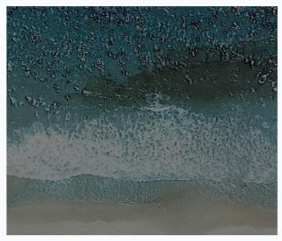
Fig 4 (page 7).
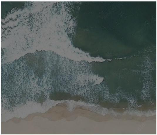
Fig 5 (page 7).
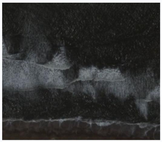
Fig 6 (page 7).
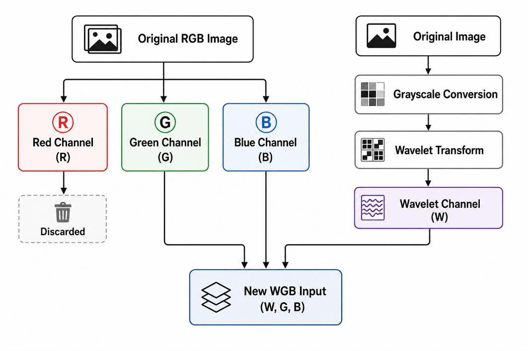
Fig 3: Dual-stream spectral-spatial CNN architecture for rip-current classification. The spatial
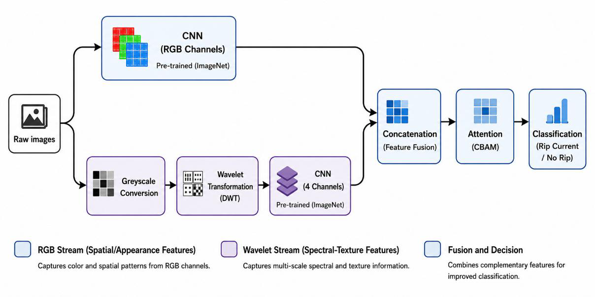
Fig 8 (page 10).
Limitations
- Dataset size is modest (2,246 images) and lacks extensive geographical diversity, potentially limiting generalization to different coastal environments.
- Wavelet-based spectral features rely on the particular choice of Daubechies 4 wavelet and a single-level decomposition; deeper or alternative wavelets were not exhaustively explored.
- No adversarial robustness evaluation was conducted to assess resilience against spoofing or intentional manipulation of imagery.
- Evaluation was conducted under the dataset-specific conditions; performance under extreme illumination, sea state, or turbidity variations remains uncertain.
- Interpretability analyses provide qualitative support but lack quantitative spatial precision evaluation comparing attention maps to ground truth rip contours.
Open questions / follow-ons
- Can multi-level or learnable wavelet decompositions further improve the spectral-spatial feature representation for rip current detection?
- How does the method generalize across different coastal geographies, seasons, and weather conditions beyond the evaluated dataset?
- What are the trade-offs in detection latency, computational complexity, and energy consumption for deploying these models on embedded UAV or edge hardware?
- Could temporal information from UAV video streams be integrated with spectral-spatial features to improve stability and early warning capability?
Why it matters for bot defense
For bot-defense and CAPTCHA practitioners, this paper demonstrates a principled approach to integrating physically interpretable frequency-domain features with deep learning to better detect subtle, texture-based anomalies in complex natural imagery. The discrete wavelet transform efficiently captures localized spatial-frequency patterns that are difficult to discern from raw RGB data alone, analogous to how specialized features might detect subtle bot behaviours in noisy data. The dual-stream approach, combined with attention mechanisms, provides a useful architectural pattern to fuse domain knowledge with learned spatial features to improve both accuracy and interpretability.
Furthermore, the channel replacement strategy offers a computationally efficient fusion technique that preserves standard input shapes while conveying enhanced spectral information—a tactic which could inspire feature engineering in bot-detection pipelines. Finally, the use of explainable AI to validate that models attend to meaningful physical indicators underscores the importance of interpretability in safety-critical systems. While the application domain differs, the methodological insights around spectral-spatial fusion, data preprocessing to avoid leakage, and interpretability checks can inform CAPTCHAs or bot defenses that rely on multimodal or subtle behavioral signals.
Cite
@article{arxiv2608_02448,
  title={ UAV-Based Environmental Monitoring of Rip-Current Indicators Using Wavelet-Derived Texture Features },
  author={ Yonatan Ben Avraham and Baruch Binyaminov and Yehudit Aperstein },
  journal={arXiv preprint arXiv:2608.02448},
  year={ 2026 },
  url={https://arxiv.org/abs/2608.02448}
}