
Air Quality Downscaling with Station-Guided Pseudo-Supervision
Source: arXiv:2607.05292 · Published 2026-07-06 · By Guorun Wang, Simone Foti, Andreas D. Demou, Leonidas Kotoulas, Theodoros Christoudias, Alexandros Koliousis et al.
TL;DR
This paper addresses the problem of downscaling coarse-resolution atmospheric composition forecasts (CAMS fields at ~40 km resolution) to fine-grained, local PM2.5 concentration estimates at ~1 km resolution over Europe. The primary challenge tackled is the mismatch between the coarse pixel-based CAMS data and the sparse, discrete point measurements from ground stations (OpenAQ). The authors propose STARQ, a station-guided framework that fuses coarse CAMS data with heterogeneous auxiliary geospatial features (human activity, land cover, elevation, satellite aerosol observations, wind fields) within a multi-scale SegFormer-based transformer architecture. A novel Gaussian-kernel pseudo-label propagation strategy transforms sparse station observations into dense target supervision by spatially interpolating and blending them with CAMS baseline values. This enables a time-agnostic, single-timestep downscaling and bias correction without temporal sequence modeling.
Extensive experiments over the European domain under strict spatial and temporal splits show STARQ consistently outperforms both the CAMS baseline and a station-guided XGBoost baseline (S-MESH*). It reduces MAE from 6.56 to 5.87 µg/m3 and RMSE from 13.7 to 12.1 µg/m3 while improving R2 from 0.03 to 0.24 at station locations. The gain is robust across different land-use types. Qualitative results confirm sharper, spatially detailed PM2.5 maps with corrected local biases. Temporal case studies demonstrate the model's ability to track pollution episodes better than CAMS. Channel importance analyses highlight the dominant role of CAMS PM2.5 and built-up urban features. Overall, STARQ proposes a scalable, spatially-aware framework for continental-scale air quality downscaling that effectively integrates sparse station data into learning.
Key findings
- STARQ improves mean absolute error (MAE) on European test stations from 6.56 µg/m3 (CAMS) and 6.49 µg/m3 (S-MESH*) to 5.87 µg/m3, a relative improvement of ~10.5% over CAMS and ~9.5% over S-MESH* (Table 2).
- Root mean squared error (RMSE) decreases from 13.72 (CAMS) and 13.08 (S-MESH*) to 12.13 µg/m3 for STARQ.
- Coefficient of determination (R2) increases from 0.029 (CAMS) and 0.118 (S-MESH*) to 0.242 with STARQ, indicating notably better explained variance.
- Across broad land-use categories (urban, industrial, agriculture, natural, water), STARQ achieves the lowest MAE and RMSE and the highest R2 scores, e.g., in water regions MAE improved from 6.61 to 4.99 and R2 from -0.392 to 0.219 (Table 3).
- Temporal evaluation at specific stations shows STARQ halves the MAE during high-pollution episodes (17.43 to 8.89) and reduces it in low-concentration regions (7.05 to 4.89) compared to CAMS (Fig 6).
- Gaussian kernel sigma (station influence radius) of ~12 pixels (~12 km) is optimal for propagating sparse station data to dense pseudo-labels (Fig 3).
- Built-up surface and volume (from GHSL) and CAMS PM2.5 fields are the input channels with greatest positive importance, while some auxiliary data (MODIS AOD, population) show neutral or slightly negative effect locally (Fig 7).
- STARQ does not require temporal sequence modeling and thus generalizes better to unseen times and stations under the challenging spatiotemporal split.
Threat model
The adversary is the spatial mismatch and sparseness between the coarse atmospheric model outputs (CAMS) and sparse, unevenly distributed PM2.5 ground-truth measurements from monitoring stations. The model assumes access to accurate point measurements but recognizes their sparse distribution, which could lead to biased or noisy supervision signals. The adversary cannot alter station data but the challenge lies in robustly extrapolating these few points to dense, high-resolution spatial estimates while correcting systematic biases in CAMS. The framework operates under the assumption that temporal sequences are unavailable or unreliable, focusing on spatial generalization instead.
Methodology — deep read
Threat Model & Assumptions: The core challenge is to produce high-resolution (~1 km) PM2.5 pollution maps by downscaling coarse-resolution (~40 km) CAMS forecast fields. The adversary, implicitly, is the spatial mismatch and sparse coverage of ground-truth measurement stations (OpenAQ), which do not provide dense supervision, and the difficulty to correct systematic biases in CAMS. The work assumes station measurements are accurate but spatially uneven and temporally irregular, while CAMS provides spatial completeness but with bias and coarse resolution. The model does not rely on temporal dependencies, instead performing time-agnostic downscaling.
Data: The training data consist of CAMS atmospheric PM2.5 forecasts at 0.4° spatial and hourly temporal resolution, covering Europe. Auxiliary spatial data include human activity (GHSL built-up surface, built-up volume, population), land cover (CORINE Land Cover), elevation (EU-DEM), satellite aerosol optical depth (MODIS MCD19A2), and wind fields (ERA5 10-meter wind). All data are resampled to a 0.01° (~1 km) European grid and temporally aligned with OpenAQ PM2.5 station measurements, which serve as point-level ground truth. The station data cover ~3,952 unique grid-aligned points and are strongly right-skewed in PM2.5 values, spanning multiple years including an Italian peninsula subset for hyperparameter tuning. Data splits enforce spatial (station-level) and temporal (timestamp-level) held-out sets for rigorous generalization evaluation.
Architecture / Algorithm: The model inputs multi-channel raster data through a shallow convolutional projector to fixed feature dimensions, followed by a hierarchical SegFormer transformer encoder with four stages (hidden dims: 256,512,1280,2048; depths: 3,8,27,3), which produces multi-scale feature maps. These outputs are projected to a common decoder dimension, upsampled to original resolution, concatenated, and fused, then passed through a convolutional regression head to produce a dense PM2.5 prediction map.
Novel Pseudo-Label Propagation: Because supervision from sparse station points is very limited, the authors introduce a Gaussian-kernel propagation that spatially interpolates station observations into dense pseudo-label maps, blending these with the coarse CAMS baseline weighted by spatial station confidence (based on Gaussian kernel summed weights). This produces a supervisory signal across the whole output map at every timestamp without relying on temporal history. The final loss combines station-level direct supervision on pixels containing stations and dense pseudo-label supervision on all other pixels.
Training Regime: The model is trained from scratch using the combined loss with weights λ_s=0.173 (station) and λ_p=0.97 (pseudo-label), optimized with AdamW at learning rate 1.31e-5 and weight decay 1.95e-5. Input patches of size 64x64 (~64 km) are randomly sampled around stations with some background patches without stations for preserving large-scale priors. Training uses a bucketed timestamp strategy grouping 4 timestamps per batch to balance I/O and temporal diversity. Hyperparameters are tuned on the Italian dataset via Optuna. Training is run on 4 NVIDIA H200 GPUs with batch size 384.
Evaluation Protocol: Testing uses held-out stations and timestamps to measure generalization. Metrics include mean absolute error (MAE), root mean squared error (RMSE), and coefficient of determination (R2) computed at station pixels. Ablations investigate the effect of different Gaussian kernel widths and input channels. Comparisons are made versus the CAMS baseline and S-MESH*, a state-of-the-art XGBoost downscaling model trained on the same data. Error metrics are also broken down by broad land-use categories. Qualitative spatial visualizations and temporal case studies at specific stations complement quantitative results.
Reproducibility: The paper mentions data sources and detailed preprocessing. It uses public datasets for CAMS, OpenAQ, GHSL, CORINE, EU-DEM, MODIS, and ERA5, though OpenAQ station distributions are uneven. Code and pretrained weights availability is not explicitly stated. Training hyperparameters and architecture details are comprehensively described. The Italian subset is used for tuning. The spatial-temporal split and patching procedures are well documented. Overall, reproducibility is supported but final code release status is unclear.
Concrete end-to-end example: For a given hour, CAMS PM2.5 and auxiliary rasters are aligned to the 1 km grid. Sparse station values are interpolated using a Gaussian kernel (σ=12.32 pixels), producing dense pseudo-label targets blending with CAMS baseline weighted by station proximity. Random 64x64 km patches centered near stations are input to the SegFormer model, which predicts PM2.5 at 1 km resolution. The prediction is supervised by a combined loss of direct station error plus dense pseudo-label MSE. Trained over many epochs, this yields a model capable of correcting coarse biased CAMS inputs to produce realistic fine-scale pollution maps even at unseen locations and times.
Technical innovations
- A novel time-agnostic Gaussian-kernel pseudo-label propagation strategy that spatially interpolates sparse station data and blends it with coarse CAMS priors to produce dense supervision for downscaling.
- Integration of heterogeneous geospatial auxiliary information (building, land cover, elevation, aerosol, wind) into a multi-scale SegFormer transformer architecture to leverage physical context in PM2.5 downscaling.
- A large-scale continental European framework that enables ×40 spatial super-resolution (~40 km to ~1 km) of PM2.5 maps without temporal sequence modeling, allowing prediction at arbitrary timestamps.
- Bucketed timestamp sampling strategy balancing spatial-temporal batch diversity while mitigating I/O bottlenecks during training.
Datasets
- CAMS forecast — hourly, 0.4° spatial resolution — public reanalysis data
- OpenAQ station measurements — ~3,952 grid-aligned stations over Europe, sparse ground-truth point observations
- GHSL (Built-up Surface, Built-up Volume, Population) — 3 arcsec resolution — public
- CORINE Land Cover (CLC) — 100 m resolution — public
- EU-DEM elevation — 1 arcsec resolution — public
- MODIS MCD19A2 Aerosol Optical Depth — 1 km resolution, daily — public
- ERA5 10-m wind components — 0.25° spatial resolution, hourly — public
- Italian subset of OpenAQ measurements (2018, 2020, 2023) — used for hyperparameter tuning
Baselines vs proposed
- CAMS Forecast: MAE = 6.562, RMSE = 13.723, R2 = 0.029 vs STARQ: MAE = 5.873, RMSE = 12.126, R2 = 0.242
- S-MESH* (XGBoost station-guided): MAE = 6.485, RMSE = 13.080, R2 = 0.118 vs STARQ: MAE = 5.873, RMSE = 12.126, R2 = 0.242
- In water land-use regions: CAMS MAE = 6.611 vs STARQ MAE = 4.986; CAMS R2 = -0.392 vs STARQ R2 = 0.219
Figures from the paper
Figures are reproduced from the source paper for academic discussion. Original copyright: the paper authors. See arXiv:2607.05292.
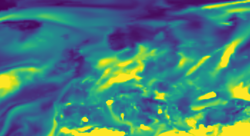
Fig 1: PM2.5 over Europe from CAMS forecast (top) and downscaled by STARQ
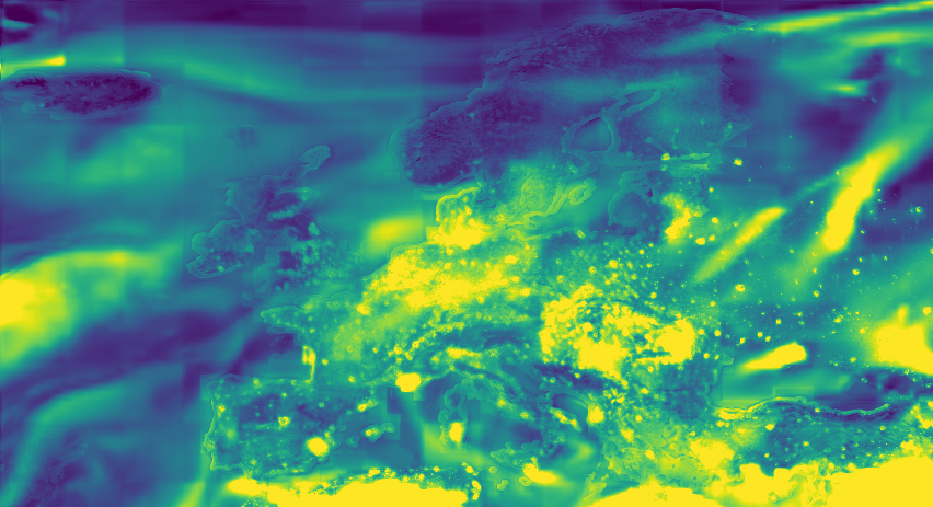
Fig 2 (page 4).

Fig 3 (page 4).
Fig 4 (page 4).

Fig 5 (page 4).
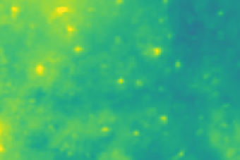
Fig 6 (page 4).

Fig 7 (page 4).
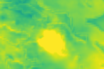
Fig 8 (page 4).
Limitations
- Sparse and uneven spatial distribution of OpenAQ station coverage limits supervision quality, especially in rural or remote areas.
- Current Gaussian-kernel pseudo-label propagation uses fixed isotropic kernels, potentially oversimplifying complex anisotropic pollutant transport under variable meteorological conditions.
- No explicit treatment or evaluation of measurement outliers or errors in OpenAQ station data.
- Temporal dynamics are ignored by the model's time-agnostic design; thus, temporal forecasting or episodic event predictions are not directly addressed.
- Evaluation focuses mainly on PM2.5 over Europe, with limited testing in other regions or pollutant species.
- Final code and pretrained model release status is unspecified, which can impede exact reproduction.
Open questions / follow-ons
- Can adaptive or anisotropic kernels better capture complex pollutant transport patterns for improved pseudo-label propagation?
- How would incorporating temporal dynamics or sequence modeling affect downscaling accuracy and the ability to forecast pollution episodes?
- How robust is the approach to station measurement errors, outliers, or missing data, and can uncertainty quantification be integrated?
- Can the method generalize effectively to other pollutants (e.g., NO2, O3) or geographic regions with different data characteristics?
Why it matters for bot defense
For bot-defense and CAPTCHA systems, this approach illustrates a sophisticated method of integrating sparse ground-truth signals into high-resolution spatial prediction frameworks through pseudo-label propagation using Gaussian kernels. The concept of converting sparse, irregularly distributed supervision into dense supervisory signals without temporal reliance could inspire CAPTCHA challenge designs that require robust spatial reasoning or context-aware feature fusion. The multi-scale transformer approach also exemplifies scalable architectures that fuse heterogeneous inputs efficiently.
However, unlike traditional bot-defense which often revolves around behavioral or interactive signals, this work focuses on spatial data fusion and bias correction under sparse supervision. Practitioners should consider the method's strength in handling sparse labeling and spatial generalization for robustness—key desirable properties for advanced CAPTCHA challenges that aim to differentiate sophisticated bots adapted to partial or noisy information.
Cite
@article{arxiv2607_05292,
  title={ Air Quality Downscaling with Station-Guided Pseudo-Supervision },
  author={ Guorun Wang and Simone Foti and Andreas D. Demou and Leonidas Kotoulas and Theodoros Christoudias and Alexandros Koliousis and Mihalis Nicolaou and Stefanos Zafeiriou },
  journal={arXiv preprint arXiv:2607.05292},
  year={ 2026 },
  url={https://arxiv.org/abs/2607.05292}
}